TTC Flood Rerouting Simulation
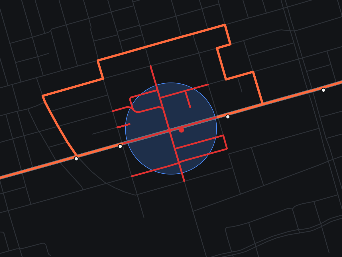
My first-year design project for ES 1050 at Western Engineering. The brief was to take on a problem related to flooding or fires and engineer a solution. Our team chose flooding in Toronto and built a simulation that reroutes TTC service around flooded streets. Try it below: click the map to flood an area.
- Sheet
- 04
- Context
- ES 1050 course project
- Period
- Winter 2025, rebuilt 2026
- Route
- 504 King
- Data
- TTC GTFS + OpenStreetMap
- Network
- 1,916 intersections
Loading map…
- Normal route
- –
- During flood
- –
- Extra distance
- –
- Roads cut
- –
Click anywhere on the map, or pick a scenario, to flood that area.
Normal routeShuttle during floodFlooded roadsFlood zone
What I did
2025 prototype (team project). We parsed the TTC’s GTFS schedule data to get the stop sequence for the 504 King, pulled Toronto’s road network from OpenStreetMap, removed roads near a flooded stop, and plotted the original and rerouted paths on an interactive map.
2026 rebuild. The prototype was rebuilt as a tested Python package and ported to the browser for this page:
- Roads are cut when their actual centreline enters the flood zone, not just when an endpoint does, so long blocks through the flood are caught
- The street network stays directed, so detours respect one-way streets
- Only the corridor around the route is downloaded and cached, instead of the whole city on every run
- Detours are measured in real distance and compared with the normal path over the same stops
- The most common daytime stop pattern is used, so overnight and short-turn variants don’t distort the route
- The 504 is a streetcar, so detours are modelled as the replacement shuttle bus that would run on the roads
Results
- Example: a 200 m flood at King & Bathurst cuts 32 road segments, closes 1 stop, and adds 1.78 km to the shuttle route
- The browser version matches the Python simulator on the same scenario and recomputes in about 10 ms, so the map updates live